Series 1
Series 1, Seminar 1 - Dr Chris Spencer Continuous continental growth as constrained by the sedimentary record
Speaker bio
Chris Spencer is an assistant professor at Queen’s University (Canada). His research is focused on the secular evolution of tectonic, magmatic, and sedimentary processes through geologic time.
Abstract
Analysis of a database of ~600,000 detrital zircon ages constrained by the depositional ages of the respective sedimentary units reveals a dynamic evolution of zircon age peaks through time. This analysis demonstrates that zircon age peaks from ancient sedimentary successions are often out of phase with the detrital zircon record obtained from modern sediments. The growth and diminishment of the zircon age peaks through time implies the presence of continental crust whose age is not proportionately represented in the modern record, and therefore that the current crustal archive is biased. However, when the detrital zircon record is viewed in terms of its evolution through time, that is taken as a time-lapse view of continental growth, it appears there never was a time in Earth history without an associated zircon age peak. The analysis of detrital zircon age peaks presented herein also reveals an evolution that can be broadly divided into three temporal groupings that broadly correspond with phases of Earth’s tectonic evolution, namely pre-supercontinent continental growth (pre-2.1 Ga), Earth’s middle age (2.1-0.8 Ga), and post-onset of modern-day plate tectonics (post-0.8 Ga). These three groupings each display increasing degrees of zircon age diversification with time, and are a likely result of a net increase of preserved continental crust through time. The presence of these three tectonic states in multiple geologic proxies (detrital zircon ages, changing styles of metamorphism, paleogeography/supercontinents) suggests that while the growth of the continental crust is continuous, the tectonic processes that shape the long-term preservation of the crust have evolved over geologic time.
Series 1, Seminar 2 - Dr Gilby Jepson Cooling history and crustal evolution of Central Asia
Speaker bio
Gilby Jepson did his PhD at the University of Adelaide exploring Central Asian tectonics. In 2019; Gilby joined the University of Arizona, USA, as a post-doctoral researcher. Gilby uses thermochronology and geochemistry to investigate the modern landscape in order to answer a range of tectonic questions.
Abstract
Central Asia is one of the most orographically diverse regions in the world, hosting the world’s highest mountains and largest orogenic systems. Understanding the crustal evolution of Central Asia can thus provide insights in to global tectonic and erosional processes. The growth of the Eurasian continent can be described by frequent Phanerozoic collision accretion events along its Tethyan Ocean margin. The upper crustal response to this complex and dynamic tectonic evolution can be resolved by exploring the cooling history of a rock as a function of erosion, tectonics, and thermal evolution. We present the first regional scale analysis of 2,526 published low-temperature thermochronometric ages from Central Asia spanning the Altai-Sayan, Tian Shan, Tibet, Pamir, and Himalaya. We compare these dates to tectonic, climatic and crustal thickness proxies in order to constrain the thermo-tectonic evolution of Central Asia. Our results indicate that the main control on cooling ages, and by inference erosion, is tectonics and their proximity to major plate boundaries. Climate plays an important role locally by enhancing erosion in areas with strong orographic barrier effects (e.g. Himalaya). The predominance of pre-Cenozoic ages in much of the Central Asia interior suggests that much of Central Asia was largely exhumed prior to the India-Eurasia collision, experiencing only localized Cenozoic reactivation. We observe a general decrease of cooling ages with latitude supporting second order climatic control on erosion.
Series 1, Seminar 3 - Prof Renata Schmitt Reconstructing Gondwana continent – challenges and advances
Speaker bio
Renata da Silva Schmitt is a Brazilian researcher who completed a bachelor in Geology at Federal University of Rio Grande do Sul (UFRGS-1991) and in Journalism at Pontifical Catholic University of Rio Grande do Sul (PUCRS -1991), master in Geosciences at UFRGS (1995) and doctorate in Geology at Federal University of Rio de Janeiro (UFRJ-2001), with a period at the University of Kansas (USA – 1998-1999). Geology professor since 2002, professor on structural geology and tectonics at UFRJ since 2009. She has the CNPq research productivity grant, and completed two post-docs: at Max Planck Institut fur Chemie (2004 – Germany) and at Australian National University (2013-Australia). During 2020, she is in a sabbatical period at University of Bern (Switzerland) working with a SNSF project on deformation and melting in shear zones. Her main line of research is the tectonic evolution of Neoproterozoic-Paleozoic orogens, with focus on correlation along South American and African margins. She coordinates the Gondwana Digital Center of Geoprocessing at UFRJ, built up during the cooperation project “Review of the geological map of Gondwana”, with CENPES (PETROBRAS 2010-2019). She was the leader of IGCP-628 – The Gondwana Map Project – The geological map and tectonic evolution of Gondwana (2013-2018).
Abstract
Gondwana lasted as a merged landmass ca. 320 m.y, from the Cambrian (ca. 500 Ma) until the Jurassic (ca. 180 Ma), comprising more than 60% of today´s continental crust, including five major continents (South America, India, Africa, Antarctica, Australia) and smaller fragments widespread in Asia, Europe and North America. Its tectonic evolution comprises three main evolutionary stages: amalgamation (670-480 Ma), development (480-180 Ma) and fragmentation (180- 85 Ma). On the 30th year anniversary of the geological map of Gondwana, scale 1:10M, by De Wit et al. (1988), an updated map will be launched as a major product from the IGCP-628 “The Gondwana Map Project– the geological map and the tectonic evolution of Gondwana”. This map emerges from an 8-year working group at the Gondwana Digital Center of Geoprocessing (GDCG), in UFRJ, Rio de Janeiro (Brazil), with collaboration of more than two hundred scientists from all over the world. We present here the new reconstruction model for Gondwana in the Jurassic, enlightening key issues: (1) the link between ancient orogenic sutures and rifted continental margins; (2) alternative tectonic fit solutions for the critical regions; (3) contrasting non-volcanic and volcanic margins with continental lithosphere inheritance. Scientific data from all Gondwana-derived fragments provided a better fit in a new reconstruction model for 180 Ma timeframe. Crustal scale shear zones, juvenile terranes, rift basins and dyke swarms were used as major onshore piercing points. Offshore data available was added to undo the actual continental margins and critical regions were partially sorted out with compilation and focused new research. Even though, some regions are still matter of debate, such as the Malvinas/Falklands plateau, Sri Lanka-Antarctica-India continental margins, India-Madagascar-Mauritia continental margins, West Antarctica-Patagonia terranes and the Southeastern Brazilian hyperextended margin.
Series 1, Seminar 4 - Prof Kent Condie Is Plate Tectonics Speeding Up?
Speaker bio
Degrees: BS Geology (1959) and MA mineralogy (1960), University of Utah; PhD, University of California, San Diego, geochemistry (1965). Kent Condie is emeritus professor of geochemistry at New Mexico Institute of Mining and Technology, Socorro, NM where he has taught since 1970. Prior to that time he was at Washington University in St. Louis, MO (1964-1970). His textbook, Plate Tectonics and Crustal Evolution, which is widely used in upper division and graduate courses in the Earth Sciences, was first published in 1976 and has gone through four previous editions. In addition Condie has written a beginning historical geology textbook with coauthor Robert Sloan, Origin and Evolution of Earth (Prentice-Hall, 1998), an advanced textbook, Mantle Plumes and Their Record in Earth History (Cambridge University Press, 2001), and a research treatise, Archean Greenstone Belts (Elsevier, 1981). His most recent book, written as an upper division/graduate textbook, is Earth as an Evolving Planetary System has gone through three editions (Elsevier, 2005; 2011; 2016). He also has edited two books, Proterozoic Crustal Evolution (Elsevier, 1992) and Archean Crustal Evolution (Elsevier, 1994). His CD ROM, Plate Tectonics and How the Earth Works is widely used in upper division Earth Science courses in the United States and Europe. Condie’s research, primarily dealing with the origin and evolution of continents and the early history of the Earth, has over the years been sponsored chiefly by the U.S. National Science Foundation. He is author or co-author of over 750 articles published scientific journals, and very frequently, the most cited author at New Mexico Tech by ResearchGate in their weekly survey.
Abstract
Although cooling of the mantle with time suggests that convection and plate tectonics should slow down with time, the following observations suggest that plate speeds may be increasing with time: The stagnant lid supercontinent stage decreases from 100 to 20 Myr in last 1.5 Ga; the frequency of collisional orogens increases from 1-7/100 Myr since the Archean; the spacing between orogen/zircon age peaks decreases from 700 to <200 Myr since 1.9 Ga; the paleomagnetic average plate speed increases from 15 to 45 deg/100 Myr since the Archean; passive margin duration decreases from 500 to <100 Myr since 1.5 Ga; and the time between LIP center activity and ocean-basin opening decreases from 80 to 30 Myr since 1.5 Ga.
An important factor controlling plate speed is the viscosity contrast across the lithosphere-asthenosphere (L-A) boundary. Although cooling of the mantle will decrease this contrast, which could lead to an increase in plate speed with time, recycling of water into the mantle may have the opposite effect. For plate speeds to increase with time, the L-A viscosity contrast must also decrease with time. To maintain a decreasing viscosity contrast at the L-A boundary, most recycled water must skip the asthenosphere and be carried into the deep mantle, perhaps by hydrous high-P phases.
Series 1, Seminar 5 - Prof Craig Storey The collisional history of continents through detrital rutile
Speaker bio
Craig Storey studied his first degree in geology at Oxford Brookes University and his PhD at Leicester University in the UK. He has held post-doctoral research positions at the Natural History Museum, the Open University and a personal fellowship at Bristol University, before securing a permanent position at the University of Portsmouth in 2009. Craig leads the Crustal Evolution and Tectonics Research Group which consists of 10 members plus research students. His research has long been based on using a combination of geochemistry and geochronology to resolve tectonic and petrogenetic problems. His tools are in-situ analytical methods such as LA-ICPMS and SIMS to measure ages and geochemical signatures within a range of accessory minerals. He has supervised 9 PhD students to completion and 4 post-doctoral researchers. He has received funding from the UK’s NERC funding agency to support his research group. He teaches metamorphic petrology, geodynamics and fieldwork at Portsmouth.
Abstract
There has been a proliferation of studies in the last decade using detrital zircon ages and isotope systematics to try and resolve some of the biggest questions in Earth evolution: when did plate tectonics start and how has the continental crust evolved and moved around over the Eons? Detrital zircon offers a way to circumvent the incomplete rock record and sample bias. However, detrital zircons derive mostly from granitoids, which is not a complete repository of the crust, nor is it the best direct recorder of subduction, accretionary and collisional processes. A mineral which grows during high grade metamorphism and is robust and ubiquitous in clastic sediments would be preferable. Rutile shows great promise and yet there are still relatively few detailed detrital rutile geochronology and geochemistry studies. Here, I discuss the advantages of detrital rutile as a complement to detrital zircon and demonstrate, with new and published data, how this can give insight to tectonic processes, the long-term evolution of the continental crust and the record of plate tectonic processes.
Series 1, Seminar 6 - Dr Lucía Pérez-Díaz Plate-driving forces: pushing plumes into the background
Speaker bio
Lucia Perez-Diaz studied Geology at the University of Oviedo (Spain) and completed a PhD in Geodynamics at Royal Holloway (University of London) for which she received the GA’s Halstead Award (2018). Since completion of her doctorate she has held postdoctoral research positions at Royal Holloway and the University of Oxford, where her research has focused on improving understanding of the feedbacks between mantle dynamics, plate-scale processes and surface observations. She has recently joined Neftex (Halliburton) as a senior geodynamics specialist. Her current work focuses on the development of quantitative plate reconstruction techniques and the study of the dynamics of plate motion (from driving forces to intraplate stress). Lucia is the vice-president of the Geologists’ Association and one of the editors of the EGU’s Geodynamics Division blog.
Abstract
Observations of the apparent links between plate speeds and the global distribution of plate boundary types have led to the suggestion that subduction may provide the largest component in the balance of torques maintaining plate motions. This would imply that plate speeds should not exceed the sinking rates of slabs into the upper mantle. Instances of this ‘speed limit’ having been broken may thus hint at the existence of driving mechanisms additional to those resulting from plate boundary forces. The arrival and emplacement of the Deccan-Réunion mantle plume beneath the Indian-African plate boundary in the 67-62 Ma period has been discussed in terms of one such additional driving mechanism. Its spatial and temporal coincidence with an abrupt speed-up of the Indian plate has led to suggestions that the arrival of plumes at the base of the lithosphere can introduce a push force capable of overwhelming entire circuits of plates and triggering plate tectonic reorganizations.We challenge the occurrence of a pulse of anticorrelating accelerations and decelerations in seafloor spreading rates around the African and Indian plates in Cretaceous-Paleogene times and, with it, question the proposal that plume-related forces play any significant role in driving plate motions.
Series 1, Seminar 7 - Assoc Prof Jo Whittaker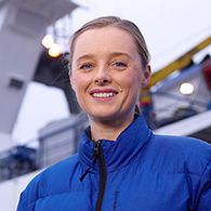 Tasman Gateway - attempts to link tectonics, plumes and ocean circulation
Speaker bio
Jo Whittaker is a marine geoscientist, at the Institute for Marine and Antarctic Science (IMAS), University of Tasmania, Hobart, Tasmania. Her background is in plate tectonic modelling and seafloor evolution, with a focus on the evolution of Australia, Antarctica, the Southern Ocean, and the Indian Ocean. More recently, she has been working with oceanographers to investigate the links among tectonics, marine sedimentation, and oceanography.
Abstract
Global and regional climate are profoundly influenced by patterns of ocean circulation, which in turn is modulated by the distribution of continents and seafloor topography. Motions of the continents over millions of years shift and reshape the ocean basins, causing ocean currents to change. Dramatic changes can occur when continents break apart or collide, opening or closing ‘seaways’ that control seawater flow between major ocean basins. The opening of polar seaways during the past 30-50 million years causing changes in polar ocean circulation patterns are linked to the onset or expansion of glaciation in both hemispheres. Jo will present an overview of their research program investigating the evolution and influence of the Tasman Gateway.
Series 1, Seminar 8 - Prof Geoff Grantham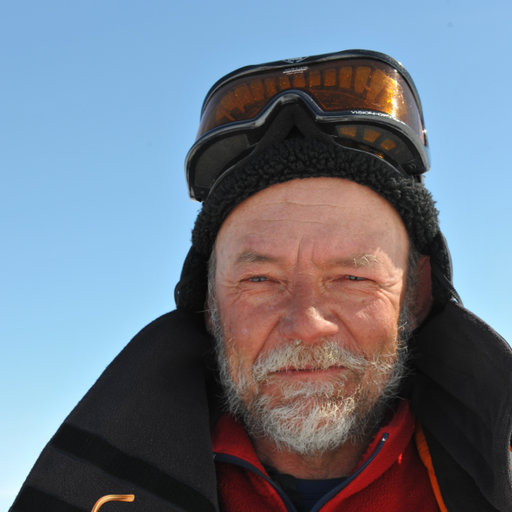 Neoproterozoic to Cambrian granitoids of northern Mozambique and Dronning Maud Land Antarctica: Implications for the assembly of Gondwana and differentiating between the EAO and Kuunga Orogenies
Speaker bio
I graduated with a BSc Hons degree in 1976. All my degrees are from University of Natal. After 4 years in industry as an exploration geologist, I realised I was an academic at heart and returned to university (1980) to do a MSc on charnockites and high grade granulites in the southern Natal Metamorphic Province. This was followed by the start of PhD in 1983 on the evolution of western Sverdrupfjella, Antarctica as a research assistant until 1989. After 5 field seasons in Antarctica, I was appointed as a lecturer at U. Pretoria in metamorphic petrology in 1989. My PhD was completed on a part time basis in 1992. Two further field seasons in Kirwanveggan, Antarctica followed in 1991/1992 and 1992/1993. In 1998 I joined the Council for Geoscience (CGS, Geological Survey of SA) involving mapping in Namaqualand, the Oman ophiolite in UAE, Mozambique (World Bank mapping 2000-2007), Tanzania, Uganda (mapping projects) and some small commercial contracts in Malawi and N. Mozambique (Xixano Complex). I joined the Japanese Antarctic Expedition (JARE51) 2009-2010 in Sor Rondane, Antarctica. Two field seasons (2013/2014 and 2014/2015) followed in Straumsnutane and Sverdrupfjella, WDML, Antarctica while at CGS. I joined the U. of Johannesburg in 2015 (semi retired) and currently as a visiting Professor to continue Antarctic research with further field seasons in 2014/2015 (Sverdrupfjella), 2015/2016 (Gjelsvikfjella), 2017/2018 (Gjelsvikfjella and W Muhlig-Hofmanfjella, CDML). Almost my whole research career has been an unplanned serendipitous journey on broadly the same belt of rocks from Namaqualand, through Natal, Mozambique and DML from Sverdrupfjella to Sor Rondane and a brief trip to Sri Lanka.
Abstract
The study covers the longest extent of the various segments of Kuunga Orogeny on the interface between Mozambique and Dronning Maud Land, Antarctica. The field relationships, petrography, whole rock major, trace element and radiogenic isotope chemistry and geochronology of Cambrian Granites from the Nampula Terrane (NT) Mozambique are reported. These data are compared with published data from Neoproterozoic to Cambrian granites from Central Dronning Land (CDML), whereas age comparisons include data from the Cabo Delgado/Namuno Terrane of northern Mozambique (CDNMT). Whereas there is significant overlap in the chemistry and ages of the granites from the Nampula Terrane compared to those from CDML and CDNMT, indicating their probable genesis within the same broad orogenic event, subtle differences in mineralogy, chemistry and age are seen. These differences include subsolvus peraluminous mica-dominated granites with ages <~530 Ma in all three areas, but concentrated in the Nampula Terrane. In contrast, dominantly metaluminous hypersolvus charnockitic syenogranites with ages >~530 Ma, are seen dominantly in CDML and lesserly in CDTNM, but absent from the Nampula Terrane and western Sverdrupfjella. The differences between the two granite varieties are inferred to reflect differences in tectonic setting during genesis with the marginally older CDML and CDTNM granites/charnockites resulting from decompression dehydration melting dominantly of amphibole-bearing country rock in an extensional setting in the hanging wall of a mega-nappe. In contrast the marginally younger NT granites were generated from dehydration melting of dominantly mica-bearing country rock in the footwall of the mega-nappe structure. The ca. 530 Ma age in Mozambique is a significant chronological boundary.
Series 1, Seminar 9 - A/Prof Bénédicte Cenki-Tok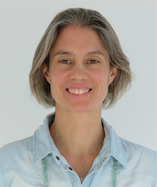 Formation and preservation of HT/UHT terranes
Speaker bio
Bénédicte Cenki-Tok is A/professor at Montpellier University (France) and currently EU H2020 Marie Curie research fellow at Sydney University. She has two decades experience in teaching and research as a hard rock geologist. Her expertise allows her to tackle two major research questions in Earth Sciences: i) how mountains build and collapse, and ii) where to find critical minerals that are essential to the development of the green technologies at the core of emerging low-carbon societies.
Abstract
Orogenesis drives the differentiation of the continental crust through metamorphic and magmatic processes, the exhumation of deep metamorphic terrains and the concomitant formation of sedimentary basins. A major consequence of prograde metamorphism following a typical orogenic thermal gradient is the dehydration and partial melting of buried rocks leading to the formation of migmatites and granulites. Partial melting and granulitisation are often intertwined and primarily linked to the availability of fluids. Here, we consider the thermal and mechanical consequences of coupled partial melting, granulitisation and strain-rate dependent retrogression during the orogenic cycle, in particular during the recovery phase when the crust’s thickness and geotherm re-equilibrate. We explore through 2D thermo-mechanical modelling how the interplay between mechanical weakening due to partial melting and mechanical strengthening due to granulitisation impacts the modes of deep crust exhumation, the formation of gneiss domes, the survival of granulitic terrains during exhumation and the partitioning of deformation through the crust.
Our results show that the survival of granulites, which strengthen the lower crust and decrease its capacity to flow under gravitational stresses, impedes the formation of migmatite-cored gneiss domes, and controls the formation and preservation of thick and strong granulitic roots. These are strong enough to stay immune to gravitational stresses and persist over hundreds of million years. These can be actually compared with stable intracontinental regions where the presence of localized crustal roots explains the remarkable variability – from 25 to 65 km – of crustal thickness. Finally, our experimental results explain as well why some ancient orogenic domains expose at the Earth’s surface dominantly granulitic terranes (e.g., Proterozoic orogens in South India, Sri Lanka, Madgascar, Antarctica, Baltica), whereas others (Variscides) expose dominantly migmatitic and granitic crust.
Series 1, Seminar 10 - Anna Gülcher Towards a recipe of the deep Earth: chemical and rheological heterogeneity in the lower mantle
Speaker bio
Anna Gülcher is a PhD student in the Geophysical Fluid Dynamics group at ETH Zürich, Switzerland. She obtained her BSc in Earth Sciences in 2016 at Utrecht University, the Netherlands, after which she moved to Switzerland to pursue a MSc degree in Geophysics at ETH Zürich. Throughout her study Anna mainly focused on numerical modelling of dynamics of planetary interiors, while keeping an interest in geology, geochemistry and seismology. Her MSc thesis addressed tectonic and volcanic activity on our neighbouring planet Venus, for which she was awarded the ETH silver medal in 2018. For her current PhD research project, she focusses on the composition and dynamics of the deep Earth and its control on our planet’s evolution. Besides her research, Anna is actively involved in the Geodynamics (GD) Division of the European Geosciences Union (EGU), as the Early Career Scientists (ECS) Representative and as one of the editors of the division’s blog website.
Abstract
The lower mantle is the largest geochemical reservoir in the Earth’s interior, and it controls the style of mantle convection and, through it, the evolution of our planet over billions of years. Constraining the composition and structure of Earth’s lower mantle, however, remains a scientific challenge that requires cross-disciplinary efforts. Questions that receive particular attention are what the nature of chemical heterogeneity in the lower mantle is, and how such heterogeneity has evolved over time and affected our planet’s evolution. In this seminar talk, Anna will showcase some of her work that is aimed at integrating recent observations on lower-mantle heterogeneity from seismology, mineral physics and geochemistry into a coherent geodynamical framework. She will focus on the formation and survival of primitive reservoirs in Earth’s mantle and their interaction and possible coexistence with recycled chemical heterogeneity. Moreover, she will touch upon a proposed style of lower-mantle rheology that is dependent on mineral fabric and deformation history, and its effect on mantle convection dynamics and plate tectonics. While she uses mainly geodynamical tools, Anna invites scientists from all disciplines of the Geosciences to join the discussion on our intertwined quest for a chemical and rheological recipe of the deep Earth.
Series 1, Seminar 11.1 - Dr Sarah Davey Progress in the Archean craton puzzle: fixing the position of Karelia-Kola in supercraton Superia using large igneous province and paleomagnetic records
Speaker bio
Sarah Davey recently completed her PhD in Earth Sciences at Carleton University (Canada). Her PhD thesis focused on testing the proposed ‘nearest-neighbour’ correlation between the Superior (Canada) and Karelia-Kola (Finland/Russia) cratonic fragments within the Superia supercraton paleogeographic reconstruction. After completing her B.Sc. in Geology at the University of Ottawa (2010), she mapped volcanic features on Venus for her M.Sc. at Carleton University (2012). Sarah has also worked for gold mining and exploration companies in Canada and Chile.
Abstract
The Neoarchean to Paleoproterozoic paleogeographic reconstruction of supercraton Superia involves the Superior and Hearne (Canada), Wyoming (USA), and Karelia-Kola (Finland/Russia) crustal fragments. Zimbabwe (Zimbabwe/Botswana), Kaapvaal (South Africa), Yilgarn and Pilbara (Australia) are other cratonic fragments suspected to belong to Superia but their relative positions are less clear. Superior and Karelia-Kola are in part linked by matching Paleoproterozoic mafic dyke swarms and sill provinces that are the preserved remnants of many pre-breakup large igneous provinces (LIPs). However, paleomagnetic datasets from Karelia-Kola yield complex results that contradict their long-lived connection.
Prior iterations of this reconstruction placed the Karelia-Kola metacraton next to the southeastern margin of Superior. This was guided by ca. 2.45 and 2.11 Ga dyke geometries, the D’ virtual geomagnetic pole (VGP; Mertanen et al., 1999) and the hypothesis that the contemporaneous ca. 2.22 Ga Nipissing sills (Superior) fed the Karjalitic sills (Karelia-Kola). However, Nd isotope data indicate that, despite having matching ages, the Karjalitic sills (εNd from -0.5 to +2.1) are not the ‘downstream’ continuation of the Nipissing sills (εNd from 0 to -6).
We present an updated reconstruction that places Karelia-Kola south of Superior and adjacent to Wyoming using the ca. 2.45 and 2.11 Ga dyke swarms and a new dyke swarm at ca. 2.40 Ga. We further assess this reconfiguration by comparing existing paleomagnetic data from Karelia-Kola to the apparent polar wander path of Superior. The ca. 2.50 Ga Shalskiy VGP, ca. 2.44 Ga D’ VGP, and ca. 2.05 Ga Kuetsyarvi VGP are consistent with contemporaneous poles from Superior in support of our updated model. This reconfiguration has implications for global Au exploration as the truncated Archean terranes in Superior (e.g., Abitibi-Wawa) with rich Au endowments do not continue into Karelia-Kola. Following a similar approach used to position Karelia-Kola, future work may allow us to locate the severed limbs of the Abitibi-Wawa terrane among some of the remaining Archean cratonic fragments yet to be placed into the evolving Superia reconstruction.
Series 1, Seminar 11.2
- Dr Michael Way & Hannah Davies
 The climates of Earth's next supercontinent: effects of tectonics, rotation rate and insolation
Speaker bios
Michael Way is a physical scientist at The NASA Goddard Institute for Space Studies in New York City, and a visiting professor in the Department of Physics & Astronomy at Uppsala University in Sweden. He was awarded his PhD in Observational Cosmology in 1998, but has also worked in Machine Learning, the History of Cosmology, and in recent years the modeling of planetary atmospheres using a three dimensional general circulation model known as ROCKE-3D. His most recently published work attempts to reconstruct Venus’ climate history over its 4.5 billion year lifespan.
Hannah Davies is a PhD Candidate at Lisbon university, Instituto Dom Luiz, Portugal. Hannah’s PhD work focuses on the link between tectonics, tides and climate over very long time scales in the deep past and future. Her work is part of a greater effort to resolve the tidal evolution of the Earth over the entire Phanerozoic, and parts of the Precambrian period.
Abstract
M. J. Way, Hannah S. Davies, Joao C. Duarte, and J. A. M. Green
We investigate two possible deep future Earth climate scenarios using a 3-D GCM[1] when the next supercontinent phase is expected to take place. In Amasia(forming ~200Myr from now) [2,3] the supercontinent forms at high northerly latitudes with the main continents ‘squished’ north of the equator while an Antarctic subcontinent remains at the south pole. In Aurica (~250Myr) [3,4] a supercontinent forms at low latitudes akin to that of a Sturtian topography. We utilize the forward evolution of plate tectonics, solar luminosity, and rotation rate in our study. The climates differences between these two scenarios are dramatic, with differences in mean surface temperatures approaching several degrees. These results demonstrate that using a simple aquaplanet or a modern Earth land/sea mask is not sufficient to explore the possible variance in theoretical modeling of extrasolar planetary atmospheres.
[1] Way et al. 2017, ApJS, 231, 21 (10.3847/1538-4365/aa7a06)
[2] Mitchell et al. 2012 Nature, 482, 208-211 (10.1038/nature10800)
[3] Davies et al. 2018 Global Planetary Change, 169, 133-144 (10.1016/j.gloplacha.2018.07.015)
[4] Duarte et al. 2018 Geological Magazine, 155 (1), 45-58 (10.1017/S0016756816000716)
Series 1, Seminar 12 - João Duarte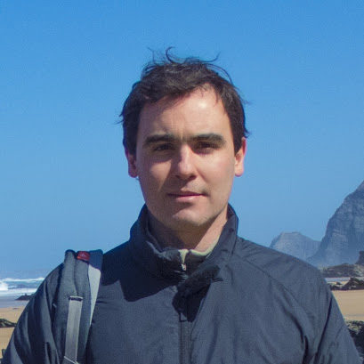 Delamination of oceanic lithosphere: a key for subduction initiation?
Speaker bio
João Duarte works in tectonics, geodynamics and marine geology. He is an Assistant Professor at the University of Lisbon, where he coordinates the research group on Continental Margins and the Deep Ocean Frontier, and the EarthSystems Doctoral School from the Instituto Dom Luiz (IDL). He completed his PhD at the University of Lisbon in 2012. In 2011, he moved to Melbourne for a Post-Doc at Monash University where he stayed until 2015.
João has edited several works, which include an AGU geophysical monograph entitled “Plate Boundaries and Natural Hazards”, an Elsevier book entitled “Transform Plate Boundaries and Fracture Zones” and an Elsevier special volume on the “200 years of geodynamic modelling”. He was awarded in 2011 an IPGP Foreign Student Award for outstanding PhD research, in 2015 he won the Discovery Early Career Researcher Award from the Australian Research Council, and in 2017 he was given the Arne Richter Award for Outstanding Early Career Scientists of the European Geosciences Union. João is passionate about science communications and he regularly collaborates with science magazines and the media.
Abstract
On the 1st of November 1755, a giant 8.7 magnitude earthquake struck off the coast of Portugal, destroying the city of Lisbon and causing great alarm all across Europe. In 1969, another 7.9 magnitude earthquake struck in the same region. Since then, many studies have been dedicated to the Atlantic margin of Portugal and several scientists proposed that this region may represent a unique case of incipient subduction in the Atlantic. Intriguingly, the epicenter of the 1969 earthquake occurred in a relatively flat abyssal plain, far from any known tectonic faults. Our studies have shown the existence of a seismicity cluster precisely below this plain at lithospheric mantle depths of ∼50 km, and tomographic models have consistently imaged a fast-velocity anomaly extending up to a depth of 250 km. We interpret this anomaly as a lithospheric drip caused by the delamination of oceanic lithosphere. We have tested this hypothesis with numerical models and they show that under certain circumstances oceanic lithosphere can indeed delaminate. Delamination of old oceanic lithosphere near passive margins may constitute a new class of subduction initiation mechanisms, with fundamental implications for the dynamics of the Wilson cycle.
Series 1, Seminar 13 - Erin Martin The core of Rodinia formed by the juxtaposition of opposed retreating and advancing accretionary orogens
Speaker bio
Erin Martin is a research associate at Monash University’s Pulse of the Earth group in Melbourne. Her current research focuses on big-data, multi-proxy records of major events in Earth history. Prior to commencing her postdoc at Monash, she completed her BSc (Hons) in Earth Science at the University of Newcastle, and PhD at Curtin University as part of the Earth Dynamics Research Group. Erin’s PhD research investigated the geodynamic evolution of the Neoproterozoic by evaluating the orogenic record preserved by zircon U-Pb-Hf systematics.
Abstract
Long-lived (800 Ma) Paleo- to Mesoproterozoic accretionary orogens on the margins of Laurentia, Baltica, Amazonia, and Kalahari collided to form the core of the supercontinent, Rodinia. Accretionary orogens in Laurentia and Baltica record predominately radiogenic zircon εHf(t) and whole-rock Pb isotopic compositions, short crustal residence times (ca. 0.5 Ga) and the development of arc-backarc complexes. The accretionary orogenic record of Laurentia and Baltica is consistent with a retreating accretionary orogen and analogous to the Phanerozoic western Pacific orogenic system. In contrast, the Mesoproterozoic orogens of Amazon and Kalahari cratons record unradiogenic zircon εHf(t) values, ca. 0.8 Ga crustal residence times, and more ancient whole-rock Pb isotopic signatures. The accretionary orogenic record of Amazonia and Kalahari indicates the preferential incorporation of cratonic material in continental arcs of advancing accretionary orogens comparable to the Phanerozoic eastern Pacific orogenic system. Based on similarities in the geodynamic evolution of the Phanerozoic circum-Pacific orogens peripheral to Gondwana/Pangea, we suggest that the Mesoproterozoic accretionary orogens formed as peripheral subduction zones along the margin of the supercontinent Nuna (ca. 1.8-1.6 Ga). The eventual collapse of this peripheral subduction zone onto itself and closure of the external ocean around Nuna to form Rodinia is equivalent to the projected future collapse of the circum-Pacific subduction zone/system and juxtaposition of Australia-Asia with South America. The juxtaposition of advancing and retreating accretionary orogens at the core of the supercontinent Rodinia demonstrates that supercontinent assembly can occur by the closure of external oceans and indicates that future closure of the Pacific Ocean is plausible.
Series 1, Seminar 14 - Luc Doucet Distinct formation history for deep-mantle domains reflected in geochemical differences
Speaker bio
Luc Doucet comes from Bourg-en-Bresse, a small town in France famously known for its blue-white-red tricoloured (delicious) chickens. After a Ph.D. in St Etienne, France (2012) he got a three years fellowship from the Belgium Fund for Scientific Research. Luc moved to Brussels to apply the “non-traditional” stable-isotope systematics on the mantle and crustal rocks to study the formation of both oceanic and continental lithosphere. After an academic career break, he moved to Curtin University, Perth in March 2018 to join Professor Li and the Earth Dynamics Research Group to work on the Oceanic Large Igneous Provinces project to decipher the present-day and past connections between Earth’s mantle, supercontinent and superocean cycles. His tools are fieldwork, clean lab, various instruments and data mining to obtain petrological, geochemical and isotopic data on mafic and ultramafic rocks. He is currently co-supervising two PhD students (one in Brussels and one in Perth), and he teaches mineralogy and geochemistry at Curtin University.
Abstract
The Earth’s mantle is currently divided into the African and Pacific domains, separated by the circum-Pacific subduction girdle and each domain features a large low shear-wave velocity provinces (LLSVPs) in the lower mantle. However, it remains controversial as to whether the LLSVPs have been stationary through time or dynamic, changing in response to changes in global subduction geometry. Here we compile radiogenic isotope data on plume-induced basalts from ocean islands and oceanic plateaus above the two LLSVPs which show distinct Pb, Nd and Sr isotopic compositions for the two mantle domains. The African domain shows enrichment by subducted continental material during the assembly and breakup of the supercontinent Pangaea, whereas no such feature is found in the Pacific domain. This deep-mantle geochemical dichotomy reflects the different evolutionary histories of the two domains during the Rodinia and Pangaea supercontinent cycles and thus supports a dynamic relationship between plate tectonics and deep mantle structures.
Series 1, Seminar 15
- Dave McCarthy & Roxana Stanca
 The Falklands Plateau, a keystone in the Break-Up of Gondwana
Speaker bios
Roxana Stanca has a background in geophysics, with a degree from the University of Bucharest, followed by an MSc in structural geology from the University of Leeds during which she focused on the regional tectonic evolution of eastern Africa (offshore Somalia). With a growing interest in past plate configurations and palaeogeographies, she started a PhD project at the same university looking at the tectonic history of the Falkland Plateau, new ways to constrain its position within south-western Gondwana and its role in understanding the evolution of the South Atlantic and transform margins in general.
Dave McCarthy is a senior geologist at the British Geological Survey in Edinburgh, where he leads the Falkland Island Basin Research Group. His current research focus is the structural evolution of the basins surrounding the Falkland Islands and how they are linked to regional scale tectonics. Dave completed his BSc (Hons) and PhD at University College Cork, his PhD research focussed on strain analysis and quantifying deformation in fold and thrust belts.
Abstract
Despite the Falklands Plateau’s significance as a crustal structure, the largest known transform marginal plateau, our knowledge of its architecture and evolution is severely limited. Many of the findings from geological and geophysical studies are widely contested. In particular the location of the plateau prior to the break-up of Gondwana is highly controversial. The segments that make up the plateau were located at the triple junction between South Africa, South America and East Antarctica, but there is an ongoing debate regarding their exact location and their behaviour during continental break-up. These uncertainties significantly affect plate tectonic models for the region.
This discussion will provide an overview of the main hypotheses and evidence from onshore correlations, but will also use an integration of gravity and 2D and 3D seismic reflection data from the Falkland Plateau Basin to provide insights into the structural architecture of this area from Jurassic onwards. The findings will be collated with published data from the North Falkland Basin and discussed in the context of the evolution of the Falklands Plateau and early fragmentation of south-western Gondwana.
